UN
3 Barclay Field
£ 700,000
Description
We don't have a Description for this property.
- Bedrooms
- 4
- Bathrooms
- 0

Leaflet © OpenStreetMap contributors
The heatmap indicates the level of crime in the area. The color of the heatmap indicates the crime severity and recency.
Metrics Year-on-Year
- Average area value
- 882,222.00 £Increased by 18.32 %
- Average area rental value
- 2,130.00 £/moDecreased by 15.31 %
- Est rental Yield
- 2.90 %Decreased by 28.40 %
- Crime Rate
- 24.00 %Unchanged by 0.00 %
from 745,607.00 £
from 2,515.00 £/mo
from 4.05 %
from 24.00 %
Nearby Schools
| Name | Type | Ofsted | Distance |
|---|---|---|---|
| St Michael'S Prep School | Other Independent School | 0.82 KM | |
| Russell House School | Other Independent School | 1.90 KM | |
| Seal Church Of England Voluntary Controlled Primary School | Voluntary Controlled School | Good | 1.93 KM |
| Kemsing Primary School | Community School | Good | 2.08 KM |
| Trinity School | Free Schools | Good | 2.23 KM |
Images
Nearby Streets
| Name | Average Price | Average Sqft | Distance |
|---|---|---|---|
| Nightingale Road | £ 577,333 | 0 | 0.00 KM |
| Boleyn Road | £ 0 | 0 | 0.00 KM |
| Station Approach | £ 0 | 0 | 0.00 KM |
Nearby Transport
| Name | NLC | TLC | Distance |
|---|---|---|---|
| Otford | 5071 | OTF | 1.59 KM |
| Bat And Ball | 5090 | BBL | 2.68 KM |
| Shoreham (Kent) | 5074 | SEH | 3.59 KM |
| Kemsing | 5079 | KMS | 4.29 KM |
| Dunton Green | 5102 | DNG | 4.52 KM |
Nearby Listings
| Address | Price | Type | Score | Distance |
|---|---|---|---|---|
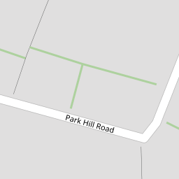
| Park Hill Road, Otford, TN14 | £ 835,000 | BUY | 8 / 10 | 0.06 KM |
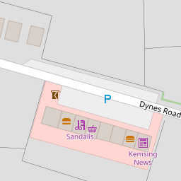
| Dynes Road, Kemsing, Sevenoaks, Kent | £ 750,000 | BUY | 8 / 10 | 0.06 KM |
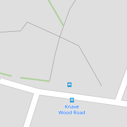
| Knavewood Road, Kemsing, Sevenoaks, TN15 | £ 685,000 | BUY | 6 / 10 | 0.10 KM |
| Dynes Road, Sevenoaks, TN15 | £ 585,000 | BUY | 6 / 10 | 0.12 KM |
| Dynes Road, Kemsing, Sevenoaks, Kent, TN15 | £ 500,000 | BUY | Unknown | 0.13 KM |
Nearby Properties
| Address | Price | Distance |
|---|---|---|
| 1 Barclay Field | £ 157,000 | 0.00 KM |
| 3 Barclay Field | £ 700,000 | 0.00 KM |
| 2 Barclay Field | £ 472,000 | 0.00 KM |
| 4 Barclay Field | £ 250,000 | 0.00 KM |
| 74 Dynes Road | £ 335,000 | 0.10 KM |